")
")
Marine Geophysics
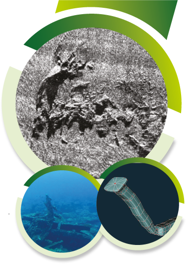
Underwater mapping
Rey Gerión generates bathymetric surveys for specific needs or as an integral part of complex projects that implement both aerial topographic techniques and terrestrial techniques. We evaluate the geology, sediments and all the elements that constitute a media mapping adapted to the needs of the project. We handle mapping projects for our partners and clients for all stages of the project, while ensuring that the work is completed efficiently and on time.
Comprehensive Underwater Archeology Services
Rey Gerión has staff that for years has been one of the main providers of underwater archaeological services, operating in territorial waters, coastal and freshwater environments. With experience working in all underwater environments, we can assure our clients that we will comply with planning and licensing conditions in a timely and efficient manner. Our diving team, commercially trained according to the standards of European and Spanish regulations, we have extensive experience in underwater archaeological monitoring, evaluation, testing and excavations having worked in a variety of shipwreck sites, structures related to ports, canals, lakes, rivers and submerged landscapes. Our quality in archaeological work has received mentions and we have had the opportunity to film with the main documentary producers in the world.

The best team of professionals at your service.
More than 40 scientific project addresses granted by the administration of 11 different countries and the participation in hundreds of underwater civil works projects and the production of 15 documentaries broadcasted by channels such as National Geographic, History Channel and DMAX and VH1.
Main Menu
More information
Contact Us
(+34) 600 440 345
info@reygerion.com